High-Precision Aerial Surveying & 3D Reality Capture
Engineering-grade drone photogrammetry, centimeter-accurate RTK positioning, and dense 3D point cloud reconstruction across Flanders and Belgium. Turnkey spatial deliverables for surveying, civil engineering, construction, and volume calculations.
Precision Geospatial Services
High-resolution aerial data capture calibrated to national geodetic datums, ASPRS spatial standards, and European aviation regulations.
3D Digital Twins
Interactive, high-fidelity virtual replicas of buildings, industrial complexes, and civil infrastructure. Optimized for structural inspection, asset lifecycle management, and spatial simulation.
Dense Point Clouds
Millions of georeferenced spatial coordinate points capturing exact surface geometry. Automated ASPRS classification separates ground, vegetation, and structures for direct CAD & BIM engineering.
True Orthomosaics
Seamless 2D orthorectified aerial mosaics with perspective distortion eliminated. Calibrated against on-site ground control targets for exact distance, boundary, and area measurements.
RTK Positioning
Onboard multi-frequency GNSS RTK hardware paired with virtual reference stations ensures millimeter positioning per camera trigger, eliminating geographic distortion across large survey tracts.
Online Client Hub
Zero software installation required. Access project digital twins directly in your browser. Measure linear lengths, compute surface areas, generate terrain profiles, and calculate stockpile volumes.
Aviation Compliance & Safety
Official commercial drone operator registered with the Belgian Civil Aviation Authority (BCAA). Certified for Open Category A1/A3, A2 Certificate of Competence, and Specific Category standard scenarios.
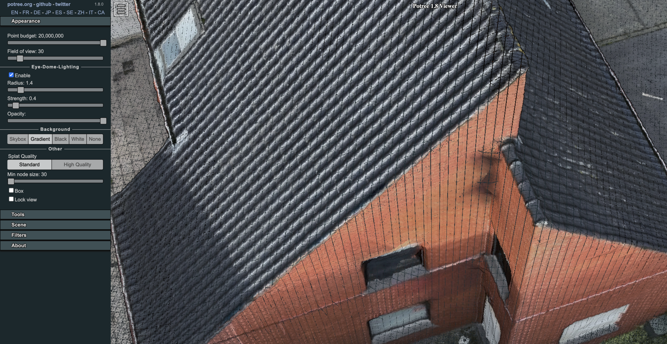
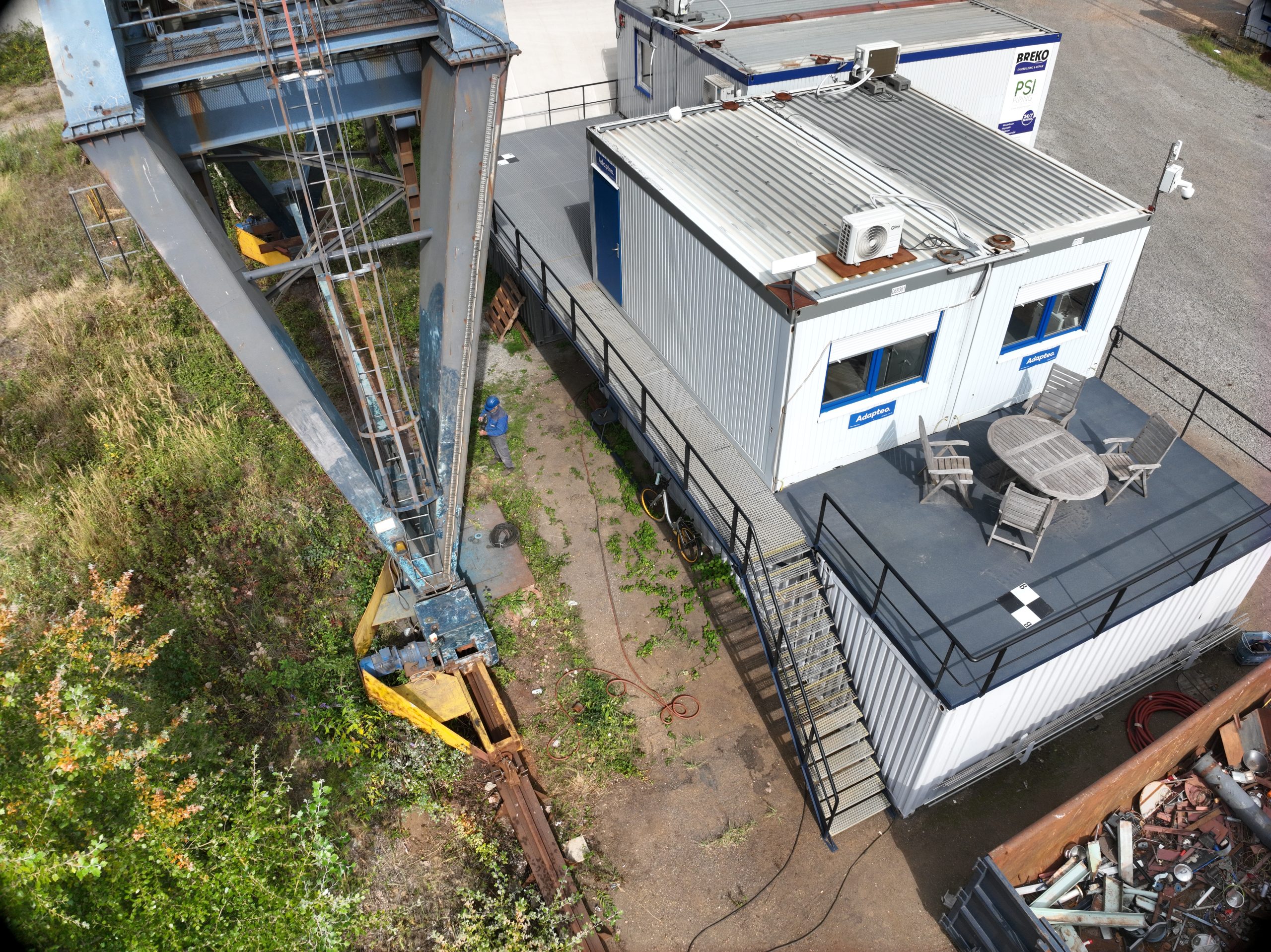
Raw Optical Capture vs. 3D Reality Model
Drag the slider below to compare raw aerial sensor imagery against the calibrated, dense 3D point cloud reconstruction.
Standard Deliverables Specification
| DELIVERABLE | FORMAT SPECIFICATIONS | ACCURACY / GSD | RECOMMENDED APPLICATION |
|---|---|---|---|
| True Orthophoto Mosaic | Cloud-Optimized GeoTIFF (COG), ECW, JPEG 2000 | 0.8 – 1.5 cm/px GSD | Cadastral overlay, GIS mapping, boundary surveying |
| Dense 3D Point Cloud | ASPRS LAS 1.4, Compressed LAZ, XYZ ASCII, Autodesk RCS | ± 15 mm XY / ± 25 mm Z | BIM as-built modeling, structural deformation, civil engineering |
| Textured 3D Mesh | OBJ + MTL, FBX, Cesium 3D Tiles | Millimeter polygon texture | Architectural visualization, virtual inspection, web simulation |
| Digital Elevation Models (DEM) | GeoTIFF (DTM bare earth & DSM surface model) | ± 25 mm vertical | Hydrology, drainage analysis, earthwork cross-sections |
| Volumetric Analysis Reports | PDF volume certificate + CSV stockpile balance | < 1.5% volumetric error | Quarry inventory, gravel depots, excavation cut & fill |
| Online Data Hub | Encrypted browser access (WebGL hardware accelerated) | Real-time interaction | Client sharing, linear measuring, annotation punch-lists |
Survey Execution Workflow
Ready to Discuss Your Survey Project?
Direct commercial dispatch for civil engineering, land development, industrial inspection, and construction monitoring across Belgium.